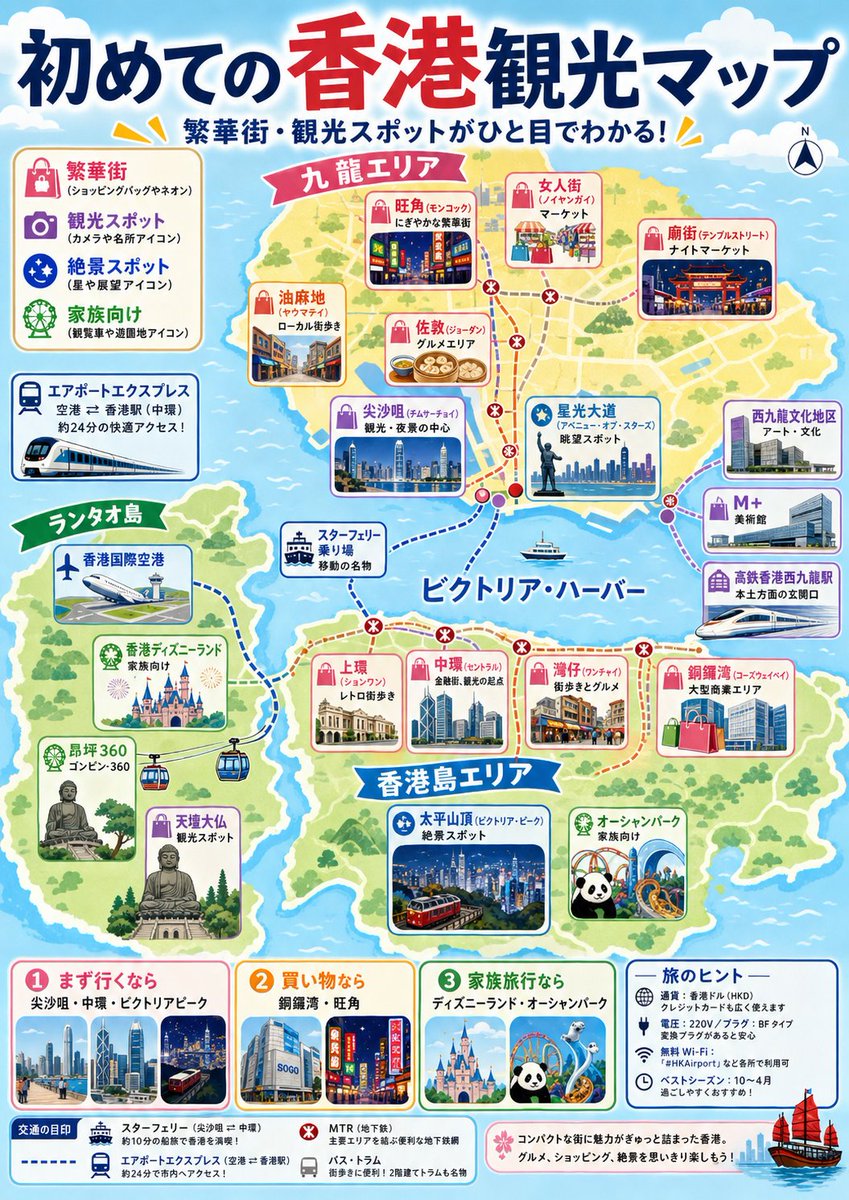
Japanese Hong Kong Tourist Map
Generates a colorful Japanese travel-map infographic for first-time Hong Kong visitors, with attraction cards, transit routes, legends, and recommendation panels.
상품 사진, 패키지, 브랜드 광고 초안 제작에 적합합니다. 주체, 재질, 배경, 상업 보정 방향이 잡혀 있어 변수만 바꿔도 빠르게 시도할 수 있습니다.
추천 비율
4:5 또는 3:4
품질 전략
먼저 가볍게 생성하고 좋은 안을 고해상도로 다듬기
생성 흐름
먼저 텍스트로 핵심 이미지를 만들고, 한 번에 중요한 요소 하나만 수정하세요.
전체 Qwen Image 프롬프트
English prompt
{"type":"colorful illustrated tourist map poster","format":"vertical A4 travel guide infographic","language":"Japanese","headline":"{argument name=\"headline text\" default=\"初めての香港観光マップ\"}","subheadline":"繁華街・観光スポットがひと目でわかる!","style":"bright friendly Japanese travel-magazine design, hand-drawn vector map, rounded cards, cute icons, thick outlines, pastel sea, green islands, lively but clean layout, highly legible print poster","map":{"destination":"{argument name=\"destination\" default=\"Hong Kong\"}","view":"simplified illustrated regional map across blue ocean with three main landmasses and dotted transit routes","main area labels":{"count":4,"labels":["九龍エリア","香港島エリア","ランタオ島","ビクトリア・ハーバー"]},"routes":"red dotted MTR route with station dots and transfer marks, purple dotted route around the harbor, blue dashed ferry/airport express routes, small boat icons on the water","compass":"small north compass in the top right"},"left legend":{"position":"upper left","title":"icon legend","count":4,"items":["繁華街 shopping bag neon icon","観光スポット camera and icon mark","絶景スポット starry night icon","家族向け Ferris wheel and green icon"]},"transport callout":{"position":"left middle","title":"エアポートエクスプレス","description":"airport to Hong Kong by train, about 24 minutes, with white-and-blue train illustration"},"attraction cards":{"total count":20,"kowloon area cards":{"count":6,"cards":["旺角(モンコック) neon shopping district","女人街(レディース街) market","廟街(テンプルストリート) night market","油麻地 local streets","佐敦(ジョーダン) dim sum area","尖沙咀(チムサーチョイ) sightseeing and night-view center"]},"victoria harbor and east cards":{"count":4,"cards":["星光大道 avenue of stars and skyline","西九龍文化地区 art and culture","M+ art museum","高鉄香港西九龍駅 high-speed rail station"]},"hong kong island cards":{"count":5,"cards":["上環 old streets","中環(セントラル) finance and sightseeing base","湾仔 nostalgic gourmet area","銅鑼湾 large shopping area","太平山頂(ビクトリア・ピーク) night-view spot with tram"]},"lantau island cards":{"count":5,"cards":["香港国際空港","香港ディズニーランド family destination","昂坪360 ropeway","天壇大仏 scenic spot","スター・フェリー乗り場 harbor transport"]}},"bottom recommendation panels":{"position":"bottom row","count":4,"panels":["1 まず行くなら: 尖沙咀・中環・ビクトリアピーク with skyline and tram","2 買い物なら: 銅鑼湾・旺角 with SOGO and neon street","3 家族旅行なら: ディズニーランド・オーシャンパーク with castle, panda, coaster","旅のヒント: practical icons for Octopus card, Wi‑Fi, weather, distance and travel tips"]},"bottom legend":{"position":"bottom edge","count":4,"items":["Star Ferry solid blue line","Airport Express blue dashed line","MTR red dotted line","bus/tram small gray icons"]},"decorative details":"clouds at the top, yellow accent rays near headings, miniature skyline photos inside rounded rectangles, small red sailing junk boat at bottom right, soft drop shadows, cheerful tourist-brochure atmosphere","accuracy instruction":"Create an attractive simplified tourism infographic rather than a geographically precise map; keep the labels in Japanese and make every major label readable.","color palette":"{argument name=\"color palette\" default=\"sky blue ocean, sandy yellow land, leafy green parks, red and navy headline, pink and blue attraction cards\"}","poster mood":"{argument name=\"poster mood\" default=\"welcoming first-time visitor guide\"}"}관련 Qwen Image 프롬프트
VR Headset Exploded View Poster
Generates a high-tech exploded view diagram of a VR headset with detailed component callouts and promotional text.
E-commerce Live Stream UI Mockup
Generates a realistic social media live stream interface overlaying a portrait, featuring customizable chat messages, gift popups, and a product purchase card.
Pancake Angel Cafe Cover
Generates a dreamy watercolor anime cover of a winged cafe angel serving honey pancakes in a sunlit morning cafe.
Summer Grape Girl 3x3 Grid Portrait
A comprehensive prompt for creating a 3x3 photo grid of a summer-themed 'Grape Girl' with specific instructions for consistency and style.
Mystical Japanese AI Face Reading Report
Generates an ornate Japanese fortune-telling appraisal sheet with a celestial portrait, moonlit gold layout, and multiple readable report sections.
Miniature City Tiny Worlds
A macro photography prompt creating a realistic miniature city built within human hair, featuring high detail and natural skin textures.