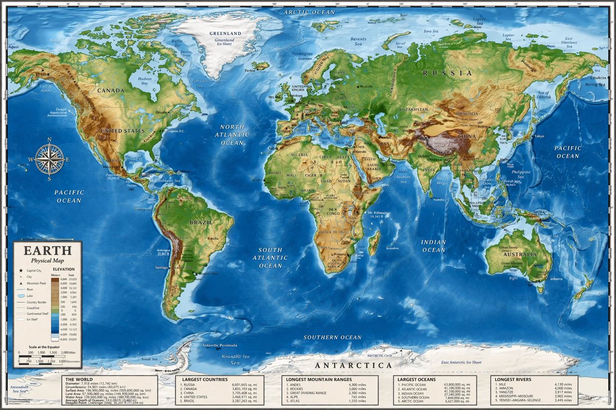
Detailed Physical World Map with Info Panels
Generates a highly detailed topographical world map featuring a legend, compass rose, and five informational data panels at the bottom.
図解、チェックリスト、ロードマップ、学習用長図に向いています。情報階層を先に決め、画像内テキストは短くすると安定します。
推奨比率
16:9 または 4:3
品質の進め方
高精細で仕上げる
生成フロー
まずテキストで主画面を作り、一度に一つの重要な要素だけ修正します。
Qwen Image 完全プロンプト
英語
{
  "type": "highly detailed cartographic world map",
  "style": "{argument name=\"color palette\" default=\"realistic topographical and bathymetric colors\"}",
  "map_features": {
    "terrain": "shaded relief showing mountains, valleys, and plains in greens, browns, and whites",
    "oceans": "depth shading in various tones of blue, with lighter blues for continental shelves and darker blues for deep trenches",
    "grid": "latitude and longitude lines spanning the entire map",
    "labels": "major continents, countries, oceans, and seas clearly labeled in serif and sans-serif typography"
  },
  "layout": {
    "overlays": [
      {
        "type": "compass rose",
        "position": "mid-left, over the Pacific Ocean",
        "description": "classic 8-point nautical compass"
      },
      {
        "type": "legend",
        "position": "bottom left",
        "title": "{argument name=\"map title\" default=\"EARTH\"}",
        "subtitle": "{argument name=\"map type\" default=\"Physical Map\"}",
        "contents": "elevation color key, map symbols, and distance scale"
      }
    ],
    "bottom_panels": {
      "count": 5,
      "position": "horizontal row along the bottom edge",
      "labels": [
        "THE WORLD",
        "LARGEST COUNTRIES",
        "LONGEST MOUNTAIN RANGES",
        "LARGEST OCEANS",
        "LONGEST RIVERS"
      ]
    }
  }
}関連するQwen Imageプロンプト
VR Headset Exploded View Poster
Generates a high-tech exploded view diagram of a VR headset with detailed component callouts and promotional text.
Illustrated City Food Map
Generates a hand-drawn, watercolor-style tourist map featuring numbered local food specialties, landmarks, and a legend.
3D Stone Staircase Evolution Infographic
Transforms a flat evolutionary timeline into a realistic 3D stone staircase infographic with detailed organism renders and structured side panels.
Momotaro Explainer Slide in Hybrid Style
A prompt that combines the simple, warm aesthetic of simple illustration style illustrations with the high-information density characteristic of Japanese government slides.
Faceless Cyberpunk Infiltrator
Generates a cinematic anime scene of an armed faceless woman infiltrating a high-security futuristic server room.
Pancake Angel Cafe Cover
Generates a dreamy watercolor anime cover of a winged cafe angel serving honey pancakes in a sunlit morning cafe.